May 31
Planning
There is no better time to plan for further adventures than while you are currently on a long adventure.
While walking the Pacific Crest Trail, I met many people who had been on the Continental Divide and Appalachian Trail. They would tell me all about it. The green tunnel, earning views, the White Mountains, trail magic, social aspects... So in 2008 I planned on hiking the AT and going canoeing in New England during the summer of 2009. Finances didn't quite allow that and instead I ended up hiking the CDT. That was a grand experience which kept the proverbial ball rolling. I planned my eastern adventure further. Other seeds festered as well. One day I would walk the length of New Zealand, bike across America, ski the Sierras, climb Denali, Sail around the world. I am a travel addict and I am not afraid to admit that.
before this particular adventure, however, I thought "Maybe it is time to get a real job, a career, a car, a home... No more backpack and carpet space in my parents' house. Well. I can't help it. I have to roam. Upon the start of this walk, or saunter I guess I am calling it, My mind once again started wandering... Bike the CDT, Go to the mountains of Western Russia, Siberia, Mongolia...
For the past 10 days, I have been walking with a hiker from California. Her trailname is Ladybird. We seem to be on a nearly identical schedule and walk a very similar speed. Well two people can dream up a lot more interesting things than just one. "How do we do this without getting a real job?" we ask. Both of us plan considerable adventures by human power. The Sierra 100 peaks, traverse Siberia, boat across Lake Baikal, and bike to the Himalayas. The mind doesn't quit.
So with all of these ideas, I just have to figure out how to finance them. For now, I will keep planning.
Monday, May 31, 2010


Wednesday, May 26, 2010
To Saunter in a Sylvan Glade
Springer Mountain to Damascus
mile 0 to mile 463.5
It has been 24 days, 21 hiking days, excuse me, walking... sauntering days. I am trying to stay away from the word "hike" it sounds like drudgery... John Muir had some words to say about this:
"Hiking – I don’t like the word or thing. People ought to saunter in the mountains – not hike! Do you know the origin of the word “saunter”? It’s a beautiful word. Away back in the Middle Ages people used to go on pilgrimages to the Holy Land, and when people in the villages through which they passed asked where they were going, they would reply “A la sainte terre”, “To the Holy Land”. And so they became known as the Sainte-Terre-ers, or Saunterers. Now these mountains are our Holy Land, and we ought to saunter through them reverently, not “hike” through them." John Muir.
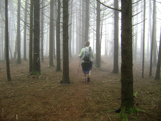
And so I saunter. I saunter quickly, but I saunter nevertheless.
---
I have never hik--- sauntered in the east. The mountains are honestly not that impressive. The tallest mountain in the east is a paltry 6800 feet, which in the Sierras would be a low hill on the way to a ski resort. The mountains in the east are old, eroded, rolling and full of history. Whereas the mountains of the west are jagged and recently glaciated. But If I wanted sharp jagged mountains, why did I go east? This is a different experience. I have walked the Sierras, the Rockies, the Winds, the Cascades, the high and low deserts, Chaparral, arid sub-alpine climates... I have descended through seven major climate zones in 17 miles on the PCT. The east has something different to offer. Gone is the everchanging environment of Southern California. I now stroll in massive hardwood forests in warm wet weather.
The humidity is alarming. The foliage is thick and verdant. Maples a nd oaks grow tall and lush and often drip considerable quantities of moisture with the slightest breeze. Poison ivy is omnipresent, with leaves ranging from small to massive, but the three adjacent leaves are easy to recognize. I have strode past many of said leave, and have yet to get a rash. The at some times daily rain must wash off the oils. Among the considerable vegetation grow sizable Rhododendrons. I didn't know they grow in forests! I seem to remember that there was one sickly Rhododendron in our front yard growing up. In the east, they tangle into a canopy above the trail. Saunterers pass beneath the shaded thickets in a tunnel. Apparently they will be exploding into color in Virginia. I look forward to it. I also seem to remember the struggling Azaleas beside our house. Here, Flame Azaleas tower almost 20 feet with bright orange flowers. And Mountain Laurels are already in full bloom.
It feels almost tropical. Rain isn't cold, the nights are alive with the chirping or bugs, the mornings are a cacophony of birdsong. I thought I might need an alarm clock after long days and hard sleep, but I do not. At dawn, my eyes open in response to the chorus of f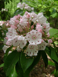 orest life springing into action. I am often packed and walking before seven.
It has rained on over half of the days, but my limited rain protection has been enough. I stride confidently in my rain skirt. One has to when wearing such things. My ponch has thus far be unaffected by blustery conditions. My pack has stayed dry.
The intake of calories is starting to ramp up. The first couple weeks are often and adjustment period. It takes a while for the body to realize exactly what is happening and send repetitive "I'm hungry" signals to the brain. Not yet have I faced the mighty half gallon of ice cream. I have dueled and lost twice with a large pizza. But the foot long sub was no contest. I will have to carry more food though now. I am sad that I can no longer get away with carrying less than 12 total ponds on my back.
mile 0 to mile 463.5
It has been 24 days, 21 hiking days, excuse me, walking... sauntering days. I am trying to stay away from the word "hike" it sounds like drudgery... John Muir had some words to say about this:
"Hiking – I don’t like the word or thing. People ought to saunter in the mountains – not hike! Do you know the origin of the word “saunter”? It’s a beautiful word. Away back in the Middle Ages people used to go on pilgrimages to the Holy Land, and when people in the villages through which they passed asked where they were going, they would reply “A la sainte terre”, “To the Holy Land”. And so they became known as the Sainte-Terre-ers, or Saunterers. Now these mountains are our Holy Land, and we ought to saunter through them reverently, not “hike” through them." John Muir.

And so I saunter. I saunter quickly, but I saunter nevertheless.
---
I have never hik--- sauntered in the east. The mountains are honestly not that impressive. The tallest mountain in the east is a paltry 6800 feet, which in the Sierras would be a low hill on the way to a ski resort. The mountains in the east are old, eroded, rolling and full of history. Whereas the mountains of the west are jagged and recently glaciated. But If I wanted sharp jagged mountains, why did I go east? This is a different experience. I have walked the Sierras, the Rockies, the Winds, the Cascades, the high and low deserts, Chaparral, arid sub-alpine climates... I have descended through seven major climate zones in 17 miles on the PCT. The east has something different to offer. Gone is the everchanging environment of Southern California. I now stroll in massive hardwood forests in warm wet weather.
The humidity is alarming. The foliage is thick and verdant. Maples a
 nd oaks grow tall and lush and often drip considerable quantities of moisture with the slightest breeze. Poison ivy is omnipresent, with leaves ranging from small to massive, but the three adjacent leaves are easy to recognize. I have strode past many of said leave, and have yet to get a rash. The at some times daily rain must wash off the oils. Among the considerable vegetation grow sizable Rhododendrons. I didn't know they grow in forests! I seem to remember that there was one sickly Rhododendron in our front yard growing up. In the east, they tangle into a canopy above the trail. Saunterers pass beneath the shaded thickets in a tunnel. Apparently they will be exploding into color in Virginia. I look forward to it. I also seem to remember the struggling Azaleas beside our house. Here, Flame Azaleas tower almost 20 feet with bright orange flowers. And Mountain Laurels are already in full bloom.
It feels almost tropical. Rain isn't cold, the nights are alive with the chirping or bugs, the mornings are a cacophony of birdsong. I thought I might need an alarm clock after long days and hard sleep, but I do not. At dawn, my eyes open in response to the chorus of f
 orest life springing into action. I am often packed and walking before seven.
It has rained on over half of the days, but my limited rain protection has been enough. I stride confidently in my rain skirt. One has to when wearing such things. My ponch has thus far be unaffected by blustery conditions. My pack has stayed dry.
The intake of calories is starting to ramp up. The first couple weeks are often and adjustment period. It takes a while for the body to realize exactly what is happening and send repetitive "I'm hungry" signals to the brain. Not yet have I faced the mighty half gallon of ice cream. I have dueled and lost twice with a large pizza. But the foot long sub was no contest. I will have to carry more food though now. I am sad that I can no longer get away with carrying less than 12 total ponds on my back.
Tuesday, April 20, 2010
Introduction
April 20 2010
Location: Home
---
It was a foregone conclusion. I would hike the Appalachian Trail. I had planned on doing this trip last year but I was a little bit low on money. This year it is different! Though I can’t say I am exactly flush, I am confident that I have enough. I have had a year to think about gear and hope to have a base weight below five pounds. (see below) The extra year was also good for planning my canoe trip. I have my maps and the guidebook is now published. It is brand new this year and was officially released in March! If there is water in the streams of New England, I will be paddling.
As usual, you can read the daily entries at www.trailjurnals.com/sangabrielat and www.trailjournals.com/gpramuknfct
Gear:
Mountain Laurel Designs Revelation and liner, 6 oz
Torso foam pad, 4 oz
Thinlite pad, 2 oz
Summer quilt, 13 oz
Tarp, 5 oz
Bivy, 5 oz
stakes, lines, 2.5 oz
total big stuff: 37.5 oz
Clothes carried:
wisp jacket, 3 oz
ID cape, 5 oz
Silnylon skirt, wrap, groundcloth, 2.5 oz
Thermals, 6 oz, 5 oz = 11 oz
socks, gloves, hat, 4.5 oz
26 oz
63.5 oz
Other stuff:
Wallet, guide, paper, pen, light 2 oz
toiletries, first aid, 4.5 oz
Toothbrush, powder, purell, bandana...
PB jar, spoon, 2 oz
watter bottles, 3 oz
bear line, carabiner, cuben fiber bag, 1.5 oz
13 oz
76.5 oz total, 4 lbs, 12.5 oz
Worn or held
Convertible pants, 8oz
long sleeve shirt, 8 oz
boxers, 3 oz
socks, 1 oz
sun hat, 2oz
Titanium Goat poles, 8 oz
camera, 5 oz
This is in flux and may change in the remaining ten days. I fly out on May 2nd.
Location: Home
---
It was a foregone conclusion. I would hike the Appalachian Trail. I had planned on doing this trip last year but I was a little bit low on money. This year it is different! Though I can’t say I am exactly flush, I am confident that I have enough. I have had a year to think about gear and hope to have a base weight below five pounds. (see below) The extra year was also good for planning my canoe trip. I have my maps and the guidebook is now published. It is brand new this year and was officially released in March! If there is water in the streams of New England, I will be paddling.
As usual, you can read the daily entries at www.trailjurnals.com/sangabrielat and www.trailjournals.com/gpramuknfct
Gear:
Mountain Laurel Designs Revelation and liner, 6 oz
Torso foam pad, 4 oz
Thinlite pad, 2 oz
Summer quilt, 13 oz
Tarp, 5 oz
Bivy, 5 oz
stakes, lines, 2.5 oz
total big stuff: 37.5 oz
Clothes carried:
wisp jacket, 3 oz
ID cape, 5 oz
Silnylon skirt, wrap, groundcloth, 2.5 oz
Thermals, 6 oz, 5 oz = 11 oz
socks, gloves, hat, 4.5 oz
26 oz
63.5 oz
Other stuff:
Wallet, guide, paper, pen, light 2 oz
toiletries, first aid, 4.5 oz
Toothbrush, powder, purell, bandana...
PB jar, spoon, 2 oz
watter bottles, 3 oz
bear line, carabiner, cuben fiber bag, 1.5 oz
13 oz
76.5 oz total, 4 lbs, 12.5 oz
Worn or held
Convertible pants, 8oz
long sleeve shirt, 8 oz
boxers, 3 oz
socks, 1 oz
sun hat, 2oz
Titanium Goat poles, 8 oz
camera, 5 oz
This is in flux and may change in the remaining ten days. I fly out on May 2nd.
Sunday, September 20, 2009
Gear... take two!
September 20 2009
Here I go on the gear again. I like gear. I talk about it a lot and don’t get tired of it. Maybe I should work in a gear shop, though I wouldn't be able to sell anyone a two wall tent or boots...
So this is what I used.
Packs
ULA Relay for New Mexico. I switched to my old GoLite Jam2 that I used on the PCT for the rest of the hike. It held up remarkably well and I wouldn’t doubt it if that pack made it through another thru hike.
Sleeping
2009 GoLite Ultra 20. The rating should be closer to 35. I picked up a cheap pink fleece baby blanket in Chama New Mexico which kept me warm in the snow. I slept on the same half length Ridgerest from last year.
Shelter
Six Moons Designs Gatewood Cape and Serenity Net Tent
22 ounces total including stakes made for a very light double wall tent system which kept me very dry. I used one of my trekking poles to set it up. It flapped a bit in the wind but I would use such a shelter again.
Cooking and hydration
I hydrated food in a plastic peanut butter jar again which worked well. I treated water with a Sawyer inline filter for the first half and used Aquamira chemical treatment for the rest. I treated about 10 total liters in Colorado due to most of the sources being from high up, with lots of snow melt. I didn’t treat much at all that came out of high mountains, and didn’t suffer any of that revenge stuff. I might go for something lighter. The Sawyer was problematic and became too difficult to use after two months
Clothes
Again I wore long sleeves, often using my Marmot wind shirt from last year. I slept in thermals often, and hiked in shorts only a few times. I used no rain gear other than a $1.99 poncho.
Shoes
Montrail Hardrock 2008 size 10.5 wide. I wish they still made them. I used five pairs and never had foot or knee problems.
Baseweight
Crazy Cook to Chama
6 lbs 4 oz
Chama to Steamboat Springs
Just below 8 lbs
Added ice axe and down jacket, and my Jam2 was slightly heavier than the Relay.
Steamboat Springs to the end
Just below 7 lbs
I ditched the axe and jacket, added a pair of running shorts and kept my blanket until near Lima. I say near Lima because I gave my blanket to a hiker who misplaced his pack 20 miles from Lima.
Here I go on the gear again. I like gear. I talk about it a lot and don’t get tired of it. Maybe I should work in a gear shop, though I wouldn't be able to sell anyone a two wall tent or boots...
So this is what I used.
Packs
ULA Relay for New Mexico. I switched to my old GoLite Jam2 that I used on the PCT for the rest of the hike. It held up remarkably well and I wouldn’t doubt it if that pack made it through another thru hike.
Sleeping
2009 GoLite Ultra 20. The rating should be closer to 35. I picked up a cheap pink fleece baby blanket in Chama New Mexico which kept me warm in the snow. I slept on the same half length Ridgerest from last year.
Shelter
Six Moons Designs Gatewood Cape and Serenity Net Tent
22 ounces total including stakes made for a very light double wall tent system which kept me very dry. I used one of my trekking poles to set it up. It flapped a bit in the wind but I would use such a shelter again.
Cooking and hydration
I hydrated food in a plastic peanut butter jar again which worked well. I treated water with a Sawyer inline filter for the first half and used Aquamira chemical treatment for the rest. I treated about 10 total liters in Colorado due to most of the sources being from high up, with lots of snow melt. I didn’t treat much at all that came out of high mountains, and didn’t suffer any of that revenge stuff. I might go for something lighter. The Sawyer was problematic and became too difficult to use after two months
Clothes
Again I wore long sleeves, often using my Marmot wind shirt from last year. I slept in thermals often, and hiked in shorts only a few times. I used no rain gear other than a $1.99 poncho.
Shoes
Montrail Hardrock 2008 size 10.5 wide. I wish they still made them. I used five pairs and never had foot or knee problems.
Baseweight
Crazy Cook to Chama
6 lbs 4 oz
Chama to Steamboat Springs
Just below 8 lbs
Added ice axe and down jacket, and my Jam2 was slightly heavier than the Relay.
Steamboat Springs to the end
Just below 7 lbs
I ditched the axe and jacket, added a pair of running shorts and kept my blanket until near Lima. I say near Lima because I gave my blanket to a hiker who misplaced his pack 20 miles from Lima.
Tuesday, September 15, 2009
And a Pair of Moose are Meese
 September 15 2009
Lincoln to Waterton
Here it is, the last stretch, and some of the most scenic terrain on the trail. There is some exposed ridges and burnt forests near the beginning of this section. However, as soon as hikers reach a low pass and start descending to Benchmark ranch and the Bob Marshal Wilderness, the trail is more pleasant, and the terrain gets much more interesting. I picked up my box at Benchmark and hiked through another burned section. That night, I camped at the base of the Chinese Wall with a nice guy from helena who was making a short trip to said geological feature.
The morning rewarded us with clear skies and warm sun. I left early and strolled along the Chinese Wall. This feature is quite amazing. East facing cliff is hundreds of vertical feet high for over ten miles. It really does look hand made.
Half way along the wall I saw Ellie, a hiker with whom I had briefly hiked in southern New
 Mexico . She was headed south.
From there I descended along an overgrown trail to a river before starting a long, fairly steep climb. The pass was intensely windy and slightly nippy. I stopped in a sheltered spot to eat dinner before continuing to a damp camp at a lake.
I want to address campsites for a moment. Thru-hikers rarely go far from the trail to camp. I for one typically go far enough that I am invisible, But I really don’t feel like walking an extra 100 feet... As I walk, I will often see a wide bit of trail and think “I could camp there” Another thing that I find interesting, at least for me and the few hikers I have hiked with, is that we don’t go for specific destinations, and very rarely camp near lakes. Lakes are damp. There is condensation... they make frequent campsites for other hikers which means frequent critter activity. If a thru hiker is not recognizable by a smaller than normal pack, early or late hiking, trail running shoes, extraordinarily dirty... They can certainly be recognized if they are camped within 20 feet of the trail.
Late the next day after dinner I saw a hiker with a small back pack across a creek. Upon getting closer I recognized him as Voyageur. For those with a short term memory, Voyageur is a hiker with whom I hiked in Washington on the PCT. He also met me in Yellowstone As he was out west meeting several people. Me, Stilts, Lucky, Lumbar, a few other west coast PCT hikers... He was about 10 days from driving home and decided to help me out a bit. We hiked a few mor
 e miles and stopped to camp... 20 feet off trail. The next day we had the opportunity to take one of the alternate trails. This route runs a ridge line climbing numerous small peaks along the way. There is no trail to speak of but the route is easy to follow.
After a frighteningly steep climb, we were on track. Part way through, we needed water. Voyageur had seen the obvious signs of a creek from the last peak and we scampered down the steep hillside and filled our bottles in a pure spring, the best water in the universe. Just afternoon clouds formed almost instantly. We were not quite at the end of the high route and several miles of exposed ridge walking remained. We decided to bail off the ridge and go cross country and find the official route.
“*FLASH BANG* I lost my footing and my poles went flying as I was knocked to the ground by the sound. little lights in my head flashed and strobed as I sat, hyperventilating on the ground. I looked down the ridge at Voyageur, who's hair was standing more on end than normal. I picked up my poles like two dead fish and tiptoed down to Voyageur, like something out of D-day, head ducked, as if that would help when hit by "1.21 gigawatts!"
"Down?" "Down!" We agreed and crashed headlong through the brush, and later thick tree cover. Crashing turned to weaving, bobbing, and ducking, and squirming as the trees grew closer together. Both of my feet went straight up in front of me and I sat down hard in the brush, looking to my left, I saw something round and blue, several.. hundreds of round blue somethings. I reached out and picked a few before getting to my feet. Now in the relative safety of tree cover, and much lower than we were a mere 10 minutes earlier, We gorged ourselves on blueberries. Completely soaked and our minds set on Mexican Food in East Glacier, we pulled ourselves reluctantly from the heavily hanging wonderful wild berries and continued through the trees, eventually emerging on a trail. Soon after that there were Thimbleberries. "Will this ever end?!?" I thought, angrily at the rain, and blissfully at the berries.” ~Me, September 1, 2009
Instead of hiking the rest of the way to East Galcier, Voyageur drove me to town and we went to the hostel. It was wet and the rain persisted.
I picked up the remaining 15 miles the next day under full sun shine. However, one horrible even happened. I lost my GPS. It had accompanied me for over 2000 miles. It was my co-pilot, my friend, my alarm clock. Wait. my friend? Well there weren’t many people to talk to, so why not. Without my GPS I might have ended up in South Dakota or something!
The day after, the third, I picked up another 10 miles by slack-packing, hiking a section without all of my gear. Ind hind sight, I could have jogged it. These were my first real views of Glacier Park. Tree line is fairly low in northern Montana. And much of my hiking was done above tree line. I started at Two Medicine after getting my hiking permit and campsite itinerary. I climbed the 2300 feet to Scenic point rath
 er quickly and made it to East glacier by early afternoon and took yet another shower! Heck, I could slack-pack the rest of the way!
All of the sudden I am camping with people. Morningstar Campground, my first designated site in Glacier Park, had six other campers. One of them even gave me a piece of freshly cooked chicken breast!


I was over Triple divide pass the next day. The day started off sunny but worsened quickly... very quickly. I had tho
 ught of climbing the peak, but it was raining and quite foggy by the time I made it to the pass. Down into the river valleys I found lots of thimbleberries. I camped in a miserably dusty burnt area at Red Eagle Lake. I received more hot food and an offer for free steak in Babb. I politely declined as I am now on a schedule, and as I have mentioned before, not exactly a steak fan.
The next day, I had a fairly long hike to Many Glacier. The trail along Sain Mary Lake was very wet with all the rain. Knee high shrubs saturated my pant legs. After Crossing the famous Going To The Sun Highway I climbed up the trail to Piegan Pass. The wind was blowing fiercely and just after the pass the rain that was following turned into ice. it felt like shards of glass, even through my pants. I hurried down the other side, my plastic poncho flapping obnoxiously. I made it to Many Glacier before 6:00 and saw Cape Cod Mike, who I had also seen in Helena.
I ended up taking a zero due to the cold weather and complicated reasons having to do with daily mileage, campsites and math. I will spare you.

And so I departed from Many Glacier on the 8th. I climbed quickly in the gusty wind and freezing temperatures to Swiftcurrent Pass. I saw numerous day hikers on the alpine trail. I joined up with The Highline Trail on the other side of the pass and spent much of the day traversing the western slope of a long ridge. Huckleberries were plentiful and the sun fought to come out. Little by little, the clouds parted and the sun poked through. By afternoon, sun shone unobstructed onto the fresh thin layer of snow atop the peaks. Just after Fifty Mountain, I took out my final map, labeled “MT1” This was it, my final night on trail.
“After my PCT hike, one of my Uncle’s ask me what I was going to do for an encore. Well... I think this qualifies. This feels much... bigger. Already. It is just more than the PCT. I don’t want to belittle the Pacific Crest trail, so don’t get me wrong. For me, this feels like it will be more of an accomplishment, maybe it is the lower number of hikers, maybe it is because I have missed less of this trail than I did on the fire shortened PCT last year.
I must digress... Once down into the valley I walked along the river, seeing a moose, eating many Thimbleberries, and eventually making it to Kootenai Lake. There, Voyageur was already waiting, unaware that I had crunched two days into one. If it were not for Voyageur, a finish at Waterton Lake might be quite a challenge logistically. I might have ended up going up to Chief Mountain. And he brought cookies and fruit!”
Instead of trying to truncate my last entry that I wrote on paper the evening of the 9th, I’ll just write it here:
“I have walked from Mexico to Canada... not once, but twice now. What is wrong with me? Why do I do this? 95 percent of the time I am uncomfortable, tired, sore, cold, hot, wet, chapped, hungry... or some combination of those things, often just thinking what I will have for my next town meal. Profound insights as to my place in the universe are quite rare. But all this hassle and money and exhaustion are unquestionably worth it when the border monument comes into view. The sun reflected off the dull silver paint and emotions flooded in and took over. I ran the final hundred yards, grinning stupidly, tears of joy welling up.

For someone who has never done a hike like this, It is difficult to describe. The sense of achievement was overwhelming. A couple passed by and I just wanted to scream out “Hey, guess what I just did!” Voyageur did that for me. They congratulated me of course and I appreciate that, but they can’t REALLY know what it is like. And it was way bigger than last year. I was more happy, more relieved, more emotional... this is quite the thing. Maybe it is the fact that the PCT has 10 times more people finish per year, maybe it was the navigation, being alone, inclement weather...
It will take me a while to... decompress after this. Part of me wants to take some time alone and think about it. Part of me NEEDS social interaction. I just want to tell everybody “I walked here!” It is not an ego thing, I don’t need a badge or a certificate to hang on my wall. It is just when you get to the border and the journey is over, you want to tell someone! It was very nice of Voyageur to meet me at the end. We had finished the PCT together.
Waterton Lake was such a great place to finish too. It reminded me a bit of the North Cascades, hints of Lake Chelan. The peaks are quite steep and dive down below the surface of the fjord-like lake. Little patches can be seen high up on the north faces. I am much happier to be finishing here, rather than the barbwire fence at the Mexican Border.
---
So I think some acknowledgements are in order. First. My parents. Thanks for getting all my food boxes together and not telling me to “Get a job, hippie!” Thanks to Tarzan And Zelda for uploading photos and support. Thanks Voyageur for driving me around! And he met me near Yellowstone after I had camped by my self for two months straight. I was just starting to develop alternate personalities! Thanks to Out of Order, who’s tracks I used on my GPS. Without those, I might still be in Colorado, or worse, maybe Nevada or something, Haha!
Though I can’t thank everyone specifically, I want to send a thank you out to people who gave me rides, water, food... Trail angels like you guys do a lot for hikers’ morale. And random acts of kindness ripple like waves through the population. I know that I will give rides and food to thru-hikers if I see them!
This thing would just about be impossible to do completely and utterly solo without some sort of help. So thank you!” ~Me, September 9, 2009
---
I am now home, in that post hike haze, my mind often drifting to some sight or event that I experienced this year. My gear is dry and packed up, ready for next season.
Wednesday, August 26, 2009
Wings

August 26 2009
Lima to Lincoln
It was 20 miles from I-15 to my first water source. I made my way down a crease in the grassy hillside and eventually found moisture which became a trickle. Even with the wet weather, the area around Lima was fairly dry. It could be challenging in a dry year. The next day I encountered a few people on trail. The first group
 was three weekenders from Missoula who were bagging some peaks in the area. They gave me a cookie, half loaf of bread, salami, water... It was a nice treat and made for an excellent lunch. Later that day I encountered four southbounders. They told me about this magical place where hikers could eat chicken wings... endless chicken wings. I still had several towns to go, so I would do what I could to get to Lincoln on a Wednesday.
The terrain wasn’t terribly interesting between Lima and Leadore, aside from a few nice mountains near the beginning of the leg. Of course, I am somewhat jaded after passing through areas like the South San Juans, the Wind River Range, and a couple of places not yet described.
I made one big climb and a long descent to the gravel road to Leadore. Here I waited for two hours while a total of three cars passed. I had made good time in hopes of getting to the post office. But I didn’t manage to get a ride until almost 5:00.

Leadore stretches a whole quarter of a mile along the highway with a couple stores and a nice little four room motel. I got a room and presently met two other hikers. There was Lost, a section hiker I had met in Silver City, and U-Haul, one more southbounder.
Despite the limited sources of entertainment in town, I took a zero... again.
---
After several days of brilliant sun and even some heat, I was once again in the rain. I found myself under my tarp on three straight afternoons. I caught up with Lost, who had left a bit before me. We hiked together through the rain which eventually turned to hail, then grapple, then real live snow. It was August 8th and it was snowing, with lightning...

We camped up high just over Goldstone Pass. The clouds didn’t part, but the rain held off until morning. I left Lost, who wasn’t exactly on a schedule. I very much would have liked to see this section as the trail gets up fairly high. Though I didn’t see the mountains I was in, I did manage to see lots of huckleberries. This slows me down a lot. A good berry patch can knock a large amount off my daily mileage.
Through the berries I went, slowly, en route to Lost Trail Pass. The last few miles gets rather violent in its topography. There were a series of short violent elevation changes. The weather on the last two days of this fairly long leg cooperated and I reached the paved road under warm sunshine.
Two hours later I was in Darby, a small touristy western themed town, not unlike Sisters in Oregon. The next leg was going to be very long, 150 miles. I rested, ate ice cream and hitched out. Well.. I tried to hitch out. I stood by the road for almost two hours before going back to the motel to call a taxi service. 30 dollars seemed steep so I tried to hitch again. Eventually I was picked up by a guy who said he was only going 10 out of the 30 miles back to the pass. I accepted the ride and chatted a bit. I offered him money to drive me the way to the pass, to which he agreed.
I didn’t have to pay for hitches on the PCT. Do I look that bad? Or are people just not used to seeing hikers.

Most of the evening’s mileage was through a burned forest under threatening skies. The next Day, I entered the Anaconda Pintler Wilderness. Thanks to continual rain and snow, I walked all day, three days in a row. I awoke early and didn’t take many breaks. I climbed the big passes and crossed the pasture lands, then crossed I-15 under rain and a double arc rainbow.
What I saw of the Pintlers was beautiful. They are steep, lined with trees, including the first Larch I had yet seen. As I passed the wispy light green conifers, I could hear a voice from Monty Python saying “The Larch. The... Larch...”
The highest pass was Rainbow Pass, topping out above 9000.
From my camp above I-15, I sprinted for route 2 and a hitch to Butte. There I stood for another two hours while countless cars whizzed by. After being picked up by a pickup truck, I walked through the historic part of the old copper mining town to the cheap motel, a decision I regretted. It is a long walk from the newer more expensive motels to the Capri. And Butte, I found, was not a pleasant pedestrian town. I was flipped off and sworn at several times. I was happy to be on my way to Helena. My hitch back to the trail, who I also paid, apologized for the rudeness I had been a victim of.
I high-tailed it northwards, very happy to be back in the woods. The next day I made easy mileage on dirt ATV roads and some trail. I found my first raspberries near Delmoe Lake. Towards the afternoon I crossed I-15 for the last time and was soon asked by a passing motorist If I wanted a ride. Where were they when I was trying to hitch? I politely declined and continued on my way.
The stretch between Butte and Helena is grassy, piny, cow-y. It is unusual for the grass here to still be green, but it was. I expected the lower areas of Montana to be dry, arid, and crawling with snakes. I guess all of this rain is welcome then. Without it, the temperature would be much higher and the water less reliable.
And so I made it to McDonald Pass after 90 easy miles. I got a ride quickly, directly to the post office. As I carried my three boxes out the door, a guy asked me where I was headed with all that stuff. He gave me ride to the budged motel in town, then surprised by giving me money. I tried to refuse, saying I wasn’t homeless, that this was a vacation... but he insisted and I graciously took the cash. I would put it back into the local economy. I was in need of chinese food, and a new book to read.
I ended up taking two zeroes in Helena, partially because I wanted to eat chicken wings in Lincoln, but mostly because Helena is a very pleasant town! People are friendly, the Cheap motel is very nice, though slightly bunker-like, the food is good, they have a good natural food store... And when I left I got a ride quickly. I saw a jeep going into town. It turned at the light and swung back around and pulled to a stop in front of me. The owner was out just driving around, getting out of the house and seemed happy to drive the 15 miles to the pass.

More of the same awaited me on trail. There was grass, beetle killed trees, and plenty of water. The last stretch was excessively roller-coaster-like. Similar to the trail before Darby and after Lincoln, the elevation changes rapidly and often. I got a ride fairly quickly from Rogers Pass to the small town of Lincoln. I got a motel room and cleaned up and prepared myself for an epic wing feed. It was Wednesday night and I was hungry.
So I sat down with a bottle of local root beer and waited for the wings to be delivered to the buffet. Eight trays were piled high with wings of different flavors. There were teriaky, ht, spicy, barbeque, sweet, and there were even two trays of pork ribs called “hog wings.” One plate into the feed, I was just getting started. I decided to pile eight on a plate to make counting easy. I took a break after four plates to eat a few veggies. I wasn’t trying for a record. I just wanted something else in my system than chicken grease. After my plate of health food I went back for two more plates... though the last plate only had five wings. After I was comfortably full, I paid my bill and asked, “Just out of curiosity, what is the record?”
“61”
I could have done it. But I was saving room for ice cream. I had a tub waiting in my freezer.
Friday, July 31, 2009
Herd
July 31 2009
Rawlins to Lima
After my 54 mile day, I limped into Anongs Thai Cuisine in Rawlins for more AYCE Asian food. I got a motel room, went to the library, did all that town stuff. I even looked into seeing a movie, but nothi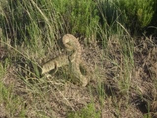 ng interesting was playing. I departed from my typical zero day and left late in the day, making about seven miles. A green Prairie Rattlesnake guarded the trail as I left the busy route 287. With a total of about 15 miles hitched so far, all on paved roads, I briefly considered hitching on 287 to Lander but resisted. This was the Great Divide Basin, a required CDT experience. Soon I left sight of traffic and was plunged into the desert. The expanse stretches as far as the eye can see, and further. The terrain is equally stark in all directions, were it not for a smattering of carsonite posts and my GPS, I wouldn’t know where to go. For two days I cruised, making 40 miles per day without really pushing hard. I now regret not bagging another 50 miler. On day three, I took a different route. The Sweetwater Creek route.
There is no trail. The maps say that there are cattle paths and game trails, but I didn’t find much. However! It was a welcome change, and though the first 15 miles of the day was very slow, it was enjoyable, only having to carry minimal water, wading across a cool creek in the hot weather.
I emerged into a car camp with a big tent, coolers, and a truck parked. I made my presence known as I had to walk through their camp. Finding two people several hundred yards further, one carrying a bow, the other a single antler, I struck up a conversation. They were a very nice couple from Lander who were interested in what I was doing and ended up giving me a sandwich and juice!

It’s not that I am a greedy mooching bum... I appreciate the generosity of total strangers. When camping and hiking, there is more opportunity for positive communication with people you don’t know. We all have a common interest. The idea of striking up a conversation with someone you pass on a metropolitan sidewalk seems bizarre. In a rural setting where nobody can be found for miles, NOT talking is bizarre. And often, a result of talking to c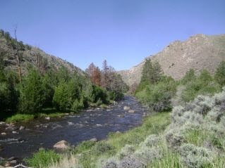 ampers is free food!
I continued after refreshments and hiked into the late evening, actually making it to a thicket of trees higher up, toward the edge of the basin by nightfall.
The next day I hitched to Lander for a zero and the baseball All-Star Game. Last year, I managed to take a zero in Etna with a TV available. The game went into extra innings and there were others in the room so I ended up not being able to see the end. This time I got my own room! This isn’t out of the ordinary on the CDT. I almost always had my own motel room.
---
The Winds! 13,000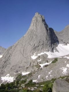 peaks! Snow! Cold water!
I don’t know why the Wind River range struck me as one of the most dramatic places I have even been. Maybe it was the extreme change in terrain. Or maybe, the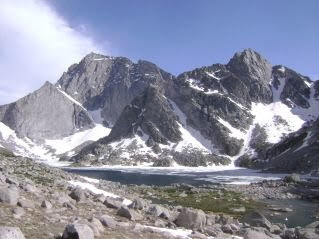 Winds are indeed one of the most dramatic places I have ever been. The first pass brought me into a land of granite boulders and alpine trees. There were vertical cliffs, snow and ice. There were frozen lakes! Here it is July 17th and lakes are still frozen! I climbed full snow coverage over a pass and descended to Temple Lake. Later that day I entered the Cirque of the Towers. I camped amidst stone monuments that would make Yosemite feel inadequate. Spires of 5.13 pitches enough to keep climbers entertained seemingly indefinitely.
The morning light shone brightly on the east faces. Patches of snow glimmered like piles of baubles and gems. I relished the sights, leaving later than normal, climbing slowly to Texas Pass. The other side was similarly spectacular. The route is cross country, but easy to follow.
Two days later, I found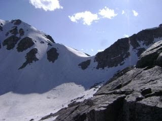 myself at a trail junction. The left led over Cube Rock Pass, the Right, over Knapsack Col. The Jonathan Ley CDT maps which most hikers use have two colors of lines. The Red is the most common, more official route. The purple represents an alternate. At his trail junction, a purple line squiggled off into the high mountains past Island Lake, and Titcomb basin. I took it.
It was a perfect clear day without a cloud in sight. I climbed gradually up into the basin and looked at my route. It was fully covered in snow. Knapsack Col was a vertical wall of snow with steep rocks on either side. As I got close, I debated whether or not to turn around and take the long way around... 20 more miles. I thought I would at least investigate. I climbed up the the rocks on the north side of the col and found a wide ledge, almost suitable for a pack animal. With a several hundred foot drop to my left and cliff face to my right, I traversed the mountain and climbed over the low cornice where the mounta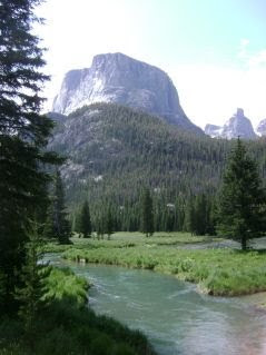 in met the pass.
I was rewarded on the other side by a glissade, more epic and vertical than any I had yet attempted. It rivaled the descent to Lake Anne in central Colorado near Twin Lakes.
Knapsack Col was not easy, and with no snow tools, I felt a little out of my element, but the views were rewarding. It was the most memorable place I was at for the entire CDT. I recommend it for those interested in a death defying challenge, otherwise, I am sure Cube Rock Pass is beautiful. But if you are in the Winds, at least go see the Cirque of the Towers. It is not technical and not that difficult.
The next day I was out of the Winds, in grassy fields full of dead pines and ticks. I made quick work of that and was in Dubois the day after. Here I met two hikers from the PCT in 2008. Voyageur had driven cross country to do some hiking and visit people. He had a car! And Stilts who showed up the same day, southbound from Canada. It was not exactly half way, but somehow we had met in a town. We had dinner and talked about our hike in 2008, and current adventures.
The next day Stilts took off south and Voyageur joined me for a section going northbound. We hiked through Yellowstone to Mack’s Inn ID.
Mileage is easy in Yellowstone, and If I knew better, I would have scheduled myself for longer days. Hikers are required to submit an exact itinerary and camp in designated campsites. Due to this and already booked camps, voyageur and I started with a couple fairly mellow days, then a paltry 15 mile day. We awoke at 8:00 left after 9:00 took breaks, sat in a hot spring, That hot spring was only three mi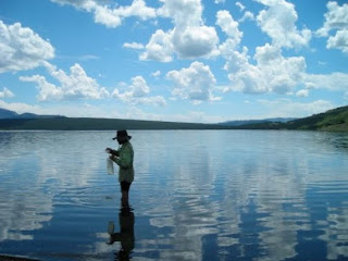 les from our camp. After we left we saw two southbound hikers... obviously not weekenders. They donned long pants and smallish backpacks. as we drew closer, we all recognized each other. It was Lumbar and Lucky. Two more PCT 2008 hikers. We chatted for an hour or so before going on to our... designated campsites. Yellowstone needs to work out a different system for thru-hikers. I am told that AT hikers can pretty much camp wherever they want in the Great Smokeys. Why can’t four hikers who manage to meet after hiking a combined 2600 miles not camp together? I’m sure we could have, but I am not in the habit of breaking the law.
The next day after an AYCE breakfast at the lodge and seeing Old Faithful blow its lid, twice, we were off, pushing for the border of the park.
The geological features, thermals, springs, chromatic pools... are very striking, amazing. I can see the draw to Yellowstone. But the hiking when not near the thermals is fairly boring. The terrain is flat and Lodgepole pines dominate the landscape. I prefer mountains.
So in Mack’s Inn, Voyageur hitched south, back to his car and I continued another 80 or so miles to Lima.
The trail into and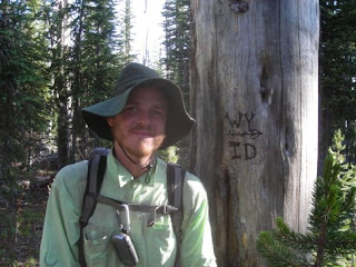 out of Mack’s Inn is on roads, However, I eventually headed off onto a unremarkable trail which faded into no trail then into waist deep flowers. I wasn’t irritated by the lack of trail. I mean how can one be angry when standing in a five mile wide wildflower field? Just try it. Go find one and try stomping around angrily.
Anyway I waded through progressively higher flowers for many miles.
After a bit of a detour, following a road which I though paralleled the trail, I found myself a couple miles off course. I met a very pleasant rancher who found the thought of “No Trespassing” signs insulting and downright stupid. His land was fenced, to keep the cows in, but He could care less if a hiker walked through his land. I told him about signs and about a bit of a hairy encounter I had in New Mexico. He just shook his head saying he didn’t know why people had to be like that. He told me to walk up one of the roads to the right and that I would end up on the Divide.
I seem to have not mentioned that “hairy encounter” (See my Entry for May 27, 2009 for that encounter.)
Almost as soon as I was back on trail, I met Flip Flop, a hiker so named because he wore flip flops. I didn’t realize this until later, as we had met at a stream and he carried very heavy looking boots, strapped to his pack.
I descended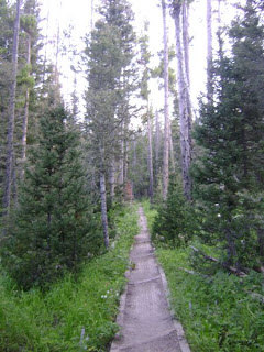 slowly from the mountains into wide open pasture with grasses and sage. I camped at the interstate.
In Lima, I met the herd. I could start naming names, but that would take up too much space. It seemed that all of the southbound hikers except for a small handful who were ahead, were here. Though i am not a steak fan, I joined the mob at the local eatery where you get to grill your own steak. I picked out a lean looking cheap cut and resisted the temptation to cut into it, flatten it, turn it every 27 seconds, or otherwise molest it. After resting on my plate for seven or eight minutes, I cut into it revealing its perfectly cooked center (though it might be a little too well-done for real meat fans’ tastes. It wasn’t bad, and the copious amount of spices I encrusted it in hid the fact that I was eating beef.
Rawlins to Lima
After my 54 mile day, I limped into Anongs Thai Cuisine in Rawlins for more AYCE Asian food. I got a motel room, went to the library, did all that town stuff. I even looked into seeing a movie, but nothi
 ng interesting was playing. I departed from my typical zero day and left late in the day, making about seven miles. A green Prairie Rattlesnake guarded the trail as I left the busy route 287. With a total of about 15 miles hitched so far, all on paved roads, I briefly considered hitching on 287 to Lander but resisted. This was the Great Divide Basin, a required CDT experience. Soon I left sight of traffic and was plunged into the desert. The expanse stretches as far as the eye can see, and further. The terrain is equally stark in all directions, were it not for a smattering of carsonite posts and my GPS, I wouldn’t know where to go. For two days I cruised, making 40 miles per day without really pushing hard. I now regret not bagging another 50 miler. On day three, I took a different route. The Sweetwater Creek route.
There is no trail. The maps say that there are cattle paths and game trails, but I didn’t find much. However! It was a welcome change, and though the first 15 miles of the day was very slow, it was enjoyable, only having to carry minimal water, wading across a cool creek in the hot weather.
I emerged into a car camp with a big tent, coolers, and a truck parked. I made my presence known as I had to walk through their camp. Finding two people several hundred yards further, one carrying a bow, the other a single antler, I struck up a conversation. They were a very nice couple from Lander who were interested in what I was doing and ended up giving me a sandwich and juice!

It’s not that I am a greedy mooching bum... I appreciate the generosity of total strangers. When camping and hiking, there is more opportunity for positive communication with people you don’t know. We all have a common interest. The idea of striking up a conversation with someone you pass on a metropolitan sidewalk seems bizarre. In a rural setting where nobody can be found for miles, NOT talking is bizarre. And often, a result of talking to c
 ampers is free food!
I continued after refreshments and hiked into the late evening, actually making it to a thicket of trees higher up, toward the edge of the basin by nightfall.
The next day I hitched to Lander for a zero and the baseball All-Star Game. Last year, I managed to take a zero in Etna with a TV available. The game went into extra innings and there were others in the room so I ended up not being able to see the end. This time I got my own room! This isn’t out of the ordinary on the CDT. I almost always had my own motel room.
---
The Winds! 13,000
 peaks! Snow! Cold water!
I don’t know why the Wind River range struck me as one of the most dramatic places I have even been. Maybe it was the extreme change in terrain. Or maybe, the
 Winds are indeed one of the most dramatic places I have ever been. The first pass brought me into a land of granite boulders and alpine trees. There were vertical cliffs, snow and ice. There were frozen lakes! Here it is July 17th and lakes are still frozen! I climbed full snow coverage over a pass and descended to Temple Lake. Later that day I entered the Cirque of the Towers. I camped amidst stone monuments that would make Yosemite feel inadequate. Spires of 5.13 pitches enough to keep climbers entertained seemingly indefinitely.
The morning light shone brightly on the east faces. Patches of snow glimmered like piles of baubles and gems. I relished the sights, leaving later than normal, climbing slowly to Texas Pass. The other side was similarly spectacular. The route is cross country, but easy to follow.
Two days later, I found
 myself at a trail junction. The left led over Cube Rock Pass, the Right, over Knapsack Col. The Jonathan Ley CDT maps which most hikers use have two colors of lines. The Red is the most common, more official route. The purple represents an alternate. At his trail junction, a purple line squiggled off into the high mountains past Island Lake, and Titcomb basin. I took it.
It was a perfect clear day without a cloud in sight. I climbed gradually up into the basin and looked at my route. It was fully covered in snow. Knapsack Col was a vertical wall of snow with steep rocks on either side. As I got close, I debated whether or not to turn around and take the long way around... 20 more miles. I thought I would at least investigate. I climbed up the the rocks on the north side of the col and found a wide ledge, almost suitable for a pack animal. With a several hundred foot drop to my left and cliff face to my right, I traversed the mountain and climbed over the low cornice where the mounta
 in met the pass.
I was rewarded on the other side by a glissade, more epic and vertical than any I had yet attempted. It rivaled the descent to Lake Anne in central Colorado near Twin Lakes.
Knapsack Col was not easy, and with no snow tools, I felt a little out of my element, but the views were rewarding. It was the most memorable place I was at for the entire CDT. I recommend it for those interested in a death defying challenge, otherwise, I am sure Cube Rock Pass is beautiful. But if you are in the Winds, at least go see the Cirque of the Towers. It is not technical and not that difficult.
The next day I was out of the Winds, in grassy fields full of dead pines and ticks. I made quick work of that and was in Dubois the day after. Here I met two hikers from the PCT in 2008. Voyageur had driven cross country to do some hiking and visit people. He had a car! And Stilts who showed up the same day, southbound from Canada. It was not exactly half way, but somehow we had met in a town. We had dinner and talked about our hike in 2008, and current adventures.
The next day Stilts took off south and Voyageur joined me for a section going northbound. We hiked through Yellowstone to Mack’s Inn ID.
Mileage is easy in Yellowstone, and If I knew better, I would have scheduled myself for longer days. Hikers are required to submit an exact itinerary and camp in designated campsites. Due to this and already booked camps, voyageur and I started with a couple fairly mellow days, then a paltry 15 mile day. We awoke at 8:00 left after 9:00 took breaks, sat in a hot spring, That hot spring was only three mi
 les from our camp. After we left we saw two southbound hikers... obviously not weekenders. They donned long pants and smallish backpacks. as we drew closer, we all recognized each other. It was Lumbar and Lucky. Two more PCT 2008 hikers. We chatted for an hour or so before going on to our... designated campsites. Yellowstone needs to work out a different system for thru-hikers. I am told that AT hikers can pretty much camp wherever they want in the Great Smokeys. Why can’t four hikers who manage to meet after hiking a combined 2600 miles not camp together? I’m sure we could have, but I am not in the habit of breaking the law.
The next day after an AYCE breakfast at the lodge and seeing Old Faithful blow its lid, twice, we were off, pushing for the border of the park.
The geological features, thermals, springs, chromatic pools... are very striking, amazing. I can see the draw to Yellowstone. But the hiking when not near the thermals is fairly boring. The terrain is flat and Lodgepole pines dominate the landscape. I prefer mountains.
So in Mack’s Inn, Voyageur hitched south, back to his car and I continued another 80 or so miles to Lima.
The trail into and
 out of Mack’s Inn is on roads, However, I eventually headed off onto a unremarkable trail which faded into no trail then into waist deep flowers. I wasn’t irritated by the lack of trail. I mean how can one be angry when standing in a five mile wide wildflower field? Just try it. Go find one and try stomping around angrily.
Anyway I waded through progressively higher flowers for many miles.
After a bit of a detour, following a road which I though paralleled the trail, I found myself a couple miles off course. I met a very pleasant rancher who found the thought of “No Trespassing” signs insulting and downright stupid. His land was fenced, to keep the cows in, but He could care less if a hiker walked through his land. I told him about signs and about a bit of a hairy encounter I had in New Mexico. He just shook his head saying he didn’t know why people had to be like that. He told me to walk up one of the roads to the right and that I would end up on the Divide.
I seem to have not mentioned that “hairy encounter” (See my Entry for May 27, 2009 for that encounter.)
Almost as soon as I was back on trail, I met Flip Flop, a hiker so named because he wore flip flops. I didn’t realize this until later, as we had met at a stream and he carried very heavy looking boots, strapped to his pack.
I descended
 slowly from the mountains into wide open pasture with grasses and sage. I camped at the interstate.
In Lima, I met the herd. I could start naming names, but that would take up too much space. It seemed that all of the southbound hikers except for a small handful who were ahead, were here. Though i am not a steak fan, I joined the mob at the local eatery where you get to grill your own steak. I picked out a lean looking cheap cut and resisted the temptation to cut into it, flatten it, turn it every 27 seconds, or otherwise molest it. After resting on my plate for seven or eight minutes, I cut into it revealing its perfectly cooked center (though it might be a little too well-done for real meat fans’ tastes. It wasn’t bad, and the copious amount of spices I encrusted it in hid the fact that I was eating beef.
Subscribe to:
Posts (Atom)
